Do You Actually Need a Flood Elevation Certificate?
Most homeowners have never heard of a flood elevation certificate until their lender or insurance agent brings it up. Suddenly it becomes urgent, confusing, and expensive sounding. The good news is that it is simpler than it sounds, and for many homeowners, it can actually reduce what they pay for flood insurance.
What Is a Flood Elevation Certificate?
A Flood Elevation Certificate is an official FEMA document prepared by a licensed land surveyor. It records how high your building sits compared to the flood level expected in your area during a major storm. Insurance companies use it to calculate how much you should pay for flood coverage.
The document is based on something called the Base Flood Elevation. This is the height that floodwaters are expected to reach during what FEMA calls a 100-year flood. That does not mean a flood happens once every 100 years. It means there is a 1% chance of that level of flooding occurring in any given year.
If your home sits above the BFE, you are considered lower risk. If it sits below, you are at higher risk. The elevation certificate is the official record that documents exactly where your home stands.
One thing worth clearing up early: a flood elevation certificate is not the same as a land survey. A land survey establishes your legal property boundaries. An elevation certificate measures the height of your structure and tells insurers and local officials how likely your home is to flood.
What Does the Certificate Actually Show?
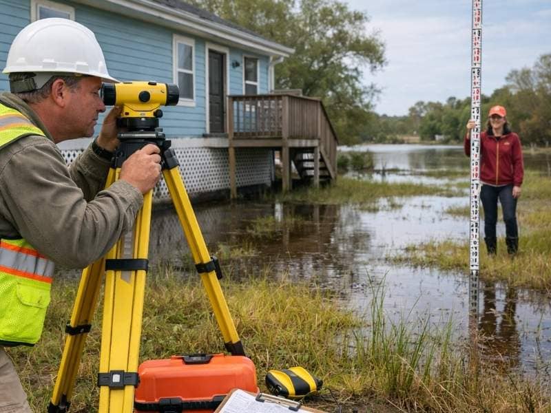
A licensed surveyor visits your property and collects specific measurements. The finished certificate includes:
- Your property’s flood zone designation, such as Zone A, AE, V, or X
- The Base Flood Elevation for your area, as set by FEMA
- The elevation of your lowest floor, including any basement or crawl space
- The elevation of the ground directly next to your building
- Details about your foundation type, flood vents, and attached garage
- Photographs of the front, rear, and sides of the building
The single most important number on the certificate is how your lowest floor compares to the BFE. That one measurement drives your flood insurance rate more than almost anything else.
So Do You Actually Need One?
This depends on your situation. You most likely need a flood elevation certificate if your property is in a high-risk flood zone, if your mortgage lender requires flood insurance, or if you are building or renovating a structure in a floodplain.
You should look into getting one if:
- Your property falls in Flood Zone A, AE, AO, AH, V, or VE, which are all designated high-risk areas
- Your lender requires you to carry flood insurance as part of your mortgage agreement
- You are constructing a new building or making major improvements to an existing one in a floodplain
- You want to challenge your flood zone designation through a FEMA Letter of Map Amendment
- You believe your current flood insurance premium is too high and want solid documentation to support a lower rate
It is also worth knowing that in 2021, FEMA introduced Risk Rating 2.0. Under this updated system, an elevation certificate is no longer required just to purchase an NFIP flood insurance policy. Premiums are now calculated using additional factors like how far your home is from water and its replacement cost. Even so, an elevation certificate can still help you qualify for discounts, and many local building codes still require one for new construction or major renovations.
How It Can Lower Your Insurance Bill
This is where the certificate earns its keep. Your flood insurance premium is directly tied to how your home’s elevation compares to the BFE. The table below shows the general relationship:
| Your Elevation vs. BFE | Effect on Premium |
| 2 or more feet above BFE | Significantly lower premium |
| At the BFE | Standard rate |
| 1 foot below BFE | Higher premium |
| 2 or more feet below BFE | Much higher premium |
Being just two feet above the BFE can reduce your annual flood insurance premium by several hundred dollars. That makes the cost of getting a certificate, which typically runs between $400 and $750 for a standard home, worth the investment many times over.
According to FEMA’s FloodSmart program, if your property meets local flood safety requirements, you may pay significantly less for flood insurance. The certificate is how you prove it.
Why More Homeowners Should Pay Attention
Flooding is the most common and costly natural disaster in the United States, yet most homeowners are not covered. A few figures put this into perspective:
- Only about 6% of U.S. households currently carry flood insurance, according to the Insurance Information Institute (2025)
- The average NFIP flood claim paid out roughly $33,905 in 2024
- Homeowners in low or moderate flood risk areas are five times more likely to experience a flood than a house fire over 30 years, according to FEMA
- During Hurricane Harvey, approximately 70% of flooded homes sat outside the officially mapped high-risk zone
- Flooding has affected 99% of U.S. counties at some point
The takeaway is that a flood zone designation on a map is not always accurate or current. A flood elevation certificate gives you property-specific data so you can make smarter decisions, not just assumptions based on a map that may be years out of date.
How to Get One
There are three ways to obtain a flood elevation certificate.
Check if one already exists. Your local floodplain manager or building department may already have a certificate on file, especially if your home was built after your community’s first Flood Insurance Rate Map was published. Call your city or county office and ask. It costs nothing to check and takes only a few minutes.
Ask the seller. If you are buying a home, always ask whether an elevation certificate exists. If the seller has one, request it as part of your purchase documents. A valid existing certificate can often be reused, which saves you the cost of ordering a new one.
Hire a licensed land surveyor. If no certificate exists, you will need to commission one. Only a licensed land surveyor, professional engineer, or licensed architect can complete and certify an elevation certificate. A land surveyor is the most common choice because they are trained to collect the precise elevation measurements the form requires. The process typically takes one to two weeks.
Frequently Asked Questions
How long does a flood elevation certificate last?
There is no official expiration date. However, your certificate may become outdated if FEMA updates the flood maps for your area, if you make major structural changes to your home, or if errors are found in the original measurements. When your community gets remapped, it is worth verifying that your certificate still reflects your current situation accurately.
Can I get one even if I am not in a flood zone?
Yes. Any property owner can request an elevation certificate, including those in low or moderate risk zones. If you think your home has been placed in the wrong flood zone, a certificate gives you the data needed to challenge that designation with FEMA.
Does my homeowner’s insurance cover flooding?
No. Standard homeowner’s insurance policies do not cover flood damage. Flood insurance must be purchased separately, either through the NFIP or a private insurer. An elevation certificate helps determine your rate for either option.
Who pays for the certificate?
The property owner pays. Costs typically range from $400 to $2,700 depending on the size and complexity of the property, with most standard homes falling around $600.
